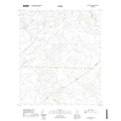
2020 Map of Glissons Millpond
USGS Topo · Published 2020About this map
Barnard Mill and the headwaters of the Canoochee River define the hydraulic character of this corner of Evans and Tattnall Counties. The landscape is dotted with private water bodies and family-named landmarks, such as Tippins Lake, Cavender Lake, and Durrence Pond, reflecting a rural economy tied to small-scale water management and agriculture. For genealogists, the map identifies several local burial grounds including Sand Hill Cem, Barnard Cem, and Antioch Cem. The complex jurisdictional boundaries of Southeast Georgia are well-represented here, where the corners of Evans, Tattnall, Liberty, Long, and Bryan Counties converge near the winding courses of Canoochee Cr and Taylors Cr. The road network, including names like Alex Tippins Rd and David Tippins Rd, further illustrates the deep-rooted family history tied to this specific coastal plain terrain.
Find a feature on this map
49 named features on this map. Tap any name to fly to it.
Don’t see what you’re looking for? This feature index may not catch every label — zoom into the map to look around manually.
Map Details
Editions of this 2020 Glissons Millpond Map
This is the sole edition of this map. No revisions or reprints were ever made.
Other maps of this area

1918 · Hinesville
USGS Topo · 1:62,500

1919 · Claxton
USGS Topo · 1:62,500

1920 · Pembroke
USGS Topo · 1:62,500

1920 · Glennville
USGS Topo · 1:62,500

1944 · Claxton
USGS Topo · 1:62,500

1944 · Glennville
USGS Topo · 1:62,500

1944 · Hinesville
USGS Topo · 1:62,500

1946 · Brunswick
USGS Topo · 1:250,000

1947 · Savannah
USGS Topo · 1:250,000

1948 · Brunswick
USGS Topo · 1:250,000