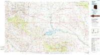
1986 Map of Globe
USGS Topo · Published 1986About this map
Globe and Miami serve as the primary industrial and population centers on this mid-1980s sheet, anchored by the heavy mining activity visible at the Strip Mine and Inspiration sites. The landscape is dominated by the vast San Carlos Indian Reservation, which encompasses the massive San Carlos Reservoir formed by the Gila River. The transportation network relies on the Southern Pacific railroad and major corridors like U S 70 and U S 60, connecting smaller communities such as Claypool, Cutter, and Peridot. Higher elevations are marked by Pinal Peak and the Mescal Mountains, while archaeological history is preserved at the Southwest Archeological Center. The convergence of tribal lands, national forests like Tonto National Forest, and copper-mining infrastructure creates a complex picture of land use in central Arizona during this era.
Find a feature on this map
93 named features on this map. Tap any name to fly to it.
Don’t see what you’re looking for? This feature index may not catch every label — zoom into the map to look around manually.
Map Details
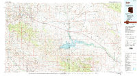
Editions of this 1986 Globe Map
2 editions found
Other maps of this area

1900 · Florence
USGS Topo · 1:125,000

1901 · Globe
USGS Topo · 1:62,500

1902 · Globe
USGS Topo · 1:62,500

1902 · Florence
USGS Topo · 1:125,000

1907 · Roosevelt
USGS Topo · 1:125,000

1909 · Four Peaks
USGS Topo · 1:125,000

1910 · Ray
USGS Topo · 1:62,500

1911 · Winkelman
USGS Topo · 1:125,000

1912 · Roosevelt
USGS Topo · 1:125,000

1913 · Winkelman
USGS Topo · 1:125,000