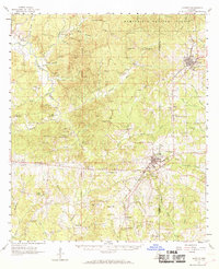
1961 Map of Gloster
USGS Topo · Published 1969About this map
Gloster and Centreville anchor this 1960s study of southwestern Mississippi, where the Illinois Central railroad dictates the orientation of small-town commerce. The landscape is a dense network of creek-fed timberlands within the Homochitto National Forest, characterized by dozens of small family and church-affiliated burial grounds. Genealogists will find high value in the precise locations of the Mt Carmel Ch Cem, Pilgrim Rest Ch Cem, and Cage Chapel Cem, which along with Finch Sch, mark the social centers of rural communities like Newtonia and Caledonia. The topography is defined by the winding course of the Buffalo River and its numerous tributaries, such as Silver Creek and Jackson Creek, interspersed with numerous Gravel Pits and early Oil Wells that highlight the local extractive economy of the era.
Find a feature on this map
126 named features on this map. Tap any name to fly to it.
Don’t see what you’re looking for? This feature index may not catch every label — zoom into the map to look around manually.
Map Details
Editions of this 1961 Gloster Map
2 editions found

Other maps of this area

1906 · Bayou Sara
USGS Topo · 1:125,000

1936 · Woodville
USGS Topo · 1:62,500

1939 · St. Francisville
USGS Topo · 1:62,500

1939 · Kingston
USGS Topo · 1:62,500

1941 · Woodland
USGS Topo · 1:31,680

1941 · Norwood
USGS Topo · 1:31,680

1941 · Lost Creek
USGS Topo · 1:31,680

1945 · Norwood
USGS Topo · 1:31,680

1945 · Lost Creek
USGS Topo · 1:31,680

1953 · Natchez
USGS Topo · 1:250,000