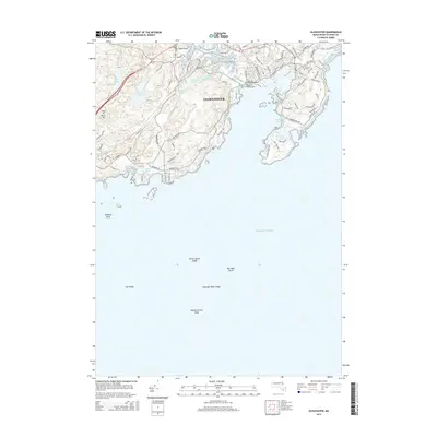
2015 Map of Gloucester
USGS Topo · Published 2015About this map
Gloucester and its intricate harbor network dominate this 2015 maritime study. The famous Blynman Drawbridge serves as a critical junction point, connecting the inner city to the peninsula of Dolliver's Neck and the residential stretches along Hesperus Ave. Inland, a chain of freshwater bodies including Haskell Pond, Dykes Pond, and the paired Upper Banjo Pond and Lower Banjo Pond provide a contrast to the salt spray of Southeast Harbor. The terrain is characterized by coastal elevations like Heap of Rocks Hill and significant navigational hazards such as Saturday Night Ledge and Naushon Point Shoal. Local researchers can trace the dense street grid from Main St to Washington St, reflecting the city's enduring layout at the mid-2010s.
Find a feature on this map
92 named features on this map. Tap any name to fly to it.
Don’t see what you’re looking for? This feature index may not catch every label — zoom into the map to look around manually.
Map Details
Editions of this 2015 Gloucester Map
This is the sole edition of this map. No revisions or reprints were ever made.
Other maps of this area

1886 · Gloucester
USGS Topo · 1:62,500

1888 · Gloucester
USGS Topo · 1:62,500

1888 · Salem
USGS Topo · 1:62,500

1892 · Boston Bay
USGS Topo · 1:62,500

1893 · Salem
USGS Topo · 1:62,500

1893 · Gloucester
USGS Topo · 1:62,500

1903 · Boston Bay
USGS Topo · 1:62,500

1917 · Salem
USGS Topo · 1:62,500

1918 · Gloucester
USGS Topo · 1:62,500

1919 · Salem
USGS Topo · 1:62,500