
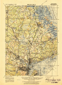
1919 Map of Salem
USGS Topo · Published 1919About this map
Salem and the surrounding North Shore towns are documented here at a peak of rail-driven connectivity just after the First World War. This coastal landscape is defined by the complex estuaries of the Ipswich River and Essex River, where the Plum Island shoreline meets an interior of dense settlements and institutional landmarks. Notable sites include the Dummer Academy near the northern boundary and the Insane Asylum west of Danvers.
Find a feature on this map
157 named features on this map. Tap any name to fly to it.
Don’t see what you’re looking for? This feature index may not catch every label — zoom into the map to look around manually.
Map Details
Editions of this 1919 Salem Map
2 editions found
Other maps of this area

1886 · Gloucester
USGS Topo · 1:62,500

1886 · Lawrence
USGS Topo · 1:62,500

1888 · Newburyport
USGS Topo · 1:62,500

1888 · Haverhill
USGS Topo · 1:62,500

1888 · Gloucester
USGS Topo · 1:62,500

1888 · Lawrence
USGS Topo · 1:62,500

1888 · Salem
USGS Topo · 1:62,500

1890 · Haverhill
USGS Topo · 1:62,500

1890 · Newburyport
USGS Topo · 1:62,500

1892 · Boston Bay
USGS Topo · 1:62,500