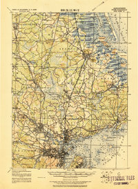
1919 Map of Salem
USGS Topo · Published 1921About this map
The coastal landscapes and industrial hubs of Essex County appear here in a transition period following World War I, documented by the Corps of Engineers. This tactical survey reveals a densely interconnected region where the Eastern Division Boston and Maine Railroad and various branches like the Essex Branch serve as the primary arteries for trade and travel between historic towns. Major institutions and landmarks anchor the geography, including the grounds of Dummer Academy to the north and the Insane Asylum near Asylum Sta. in the south.
Find a feature on this map
201 named features on this map. Tap any name to fly to it.
Don’t see what you’re looking for? This feature index may not catch every label — zoom into the map to look around manually.
Map Details
Editions of this 1919 Salem Map
2 editions found

Other maps of this area

1886 · Gloucester
USGS Topo · 1:62,500

1886 · Lawrence
USGS Topo · 1:62,500

1888 · Newburyport
USGS Topo · 1:62,500

1888 · Haverhill
USGS Topo · 1:62,500

1888 · Gloucester
USGS Topo · 1:62,500

1888 · Lawrence
USGS Topo · 1:62,500

1888 · Salem
USGS Topo · 1:62,500

1890 · Haverhill
USGS Topo · 1:62,500

1890 · Newburyport
USGS Topo · 1:62,500

1892 · Boston Bay
USGS Topo · 1:62,500