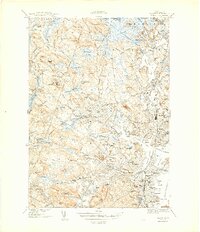
1944 Map of Salem
USGS Topo · Published 1944About this map
Salem and its surrounding coastal industrial towns are captured here during the Second World War, showing a landscape defined by its deep maritime history and complex social infrastructure. The map details the dense rail network of the Boston and Maine railroad connecting regional hubs like Peabody, Beverly, and Danvers Center. Extensive institutional footprints are visible across the hills, including the sprawling Danvers State Hospital, the County Sanatorium, and the Peabody Infirmary. Along the waterfront, the commercial legacy of Beverly Harbor and the North River is evidenced by Derby Wharf and Salem Terminal Wharf, while defensive positions like Fort Pickering and Fort Lee guard the approaches to Collins Cove. This survey preserves the locations of numerous historic burial sites, from the colonial-era Bradstreet & Porter Burying Ground to the Sons of Jacob Cem, reflecting the diverse genealogy of Essex County.
Find a feature on this map
122 named features on this map. Tap any name to fly to it.
Don’t see what you’re looking for? This feature index may not catch every label — zoom into the map to look around manually.
Map Details
Editions of this 1944 Salem Map
3 editions found
Other maps of this area

1886 · Lawrence
USGS Topo · 1:62,500

1888 · Lawrence
USGS Topo · 1:62,500

1888 · Salem
USGS Topo · 1:62,500

1892 · Boston Bay
USGS Topo · 1:62,500

1893 · Salem
USGS Topo · 1:62,500

1893 · Boston
USGS Topo · 1:62,500

1893 · Lawrence
USGS Topo · 1:62,500

1903 · Boston
USGS Topo · 1:62,500

1903 · Boston Bay
USGS Topo · 1:62,500

1917 · Salem
USGS Topo · 1:62,500