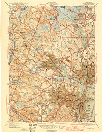
1944 Map of Salem
USGS Topo · Published 1944About this map
The North Shore's maritime and industrial landscape unfolds in this mid-century survey, anchored by the bustling waterfronts of Salem Harbor and Beverly Harbor. Industry and institutional history are prominent, with the extensive grounds of Danvers State Hospital and the County Agricultural Sch situated near the intersection of various branches of the Boston and Maine railroad. Along the inlets of the Waters River and Bass River, the map captures the transition from working waterfronts like Derby Wharf and Salem Terminal Wharf to the dense residential neighborhoods of Rial Side and Tapleyville.
Find a feature on this map
123 named features on this map. Tap any name to fly to it.
Don’t see what you’re looking for? This feature index may not catch every label — zoom into the map to look around manually.
Map Details
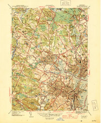
Editions of this 1944 Salem Map
3 editions found
Other maps of this area

1886 · Lawrence
USGS Topo · 1:62,500

1888 · Lawrence
USGS Topo · 1:62,500

1888 · Salem
USGS Topo · 1:62,500

1892 · Boston Bay
USGS Topo · 1:62,500

1893 · Salem
USGS Topo · 1:62,500

1893 · Boston
USGS Topo · 1:62,500

1893 · Lawrence
USGS Topo · 1:62,500

1903 · Boston
USGS Topo · 1:62,500

1903 · Boston Bay
USGS Topo · 1:62,500

1917 · Salem
USGS Topo · 1:62,500