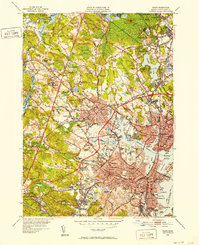
1949 Map of Salem
USGS Topo · Published 1952About this map
Salem and its neighboring North Shore communities appear here at the mid-century peak of their industrial and institutional development. The landscape is heavily marked by regional infrastructure, from the sprawling campus of the Danvers State Hospital and St Johns Preparatory Sch to the dense network of the Boston and Maine RR connecting Peabody and Danvers. This 1949 revision shows the area's transition into a modern suburban hub, yet it preserves deep historical layers through sites like the Old Settlers Burying Ground and Gallows Hill. Along the coast, Salem Harbor remains a focal point of maritime activity, featuring the Derby Wharf and the Salem Terminal Wharf. The map also captures several local institutions that shaped the social fabric of the era, including the State Teachers College and the County Agricultural Sch in Hathorne. Extensive swamps like Wenham Swamp and Blind Hole Swamp illustrate the natural barriers that guided early settlement patterns.
Find a feature on this map
128 named features on this map. Tap any name to fly to it.
Don’t see what you’re looking for? This feature index may not catch every label — zoom into the map to look around manually.
Map Details
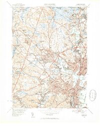
Editions of this 1949 Salem Map
2 editions found
Other maps of this area

1886 · Lawrence
USGS Topo · 1:62,500

1888 · Lawrence
USGS Topo · 1:62,500

1888 · Salem
USGS Topo · 1:62,500

1892 · Boston Bay
USGS Topo · 1:62,500

1893 · Salem
USGS Topo · 1:62,500

1893 · Boston
USGS Topo · 1:62,500

1893 · Lawrence
USGS Topo · 1:62,500

1903 · Boston
USGS Topo · 1:62,500

1903 · Boston Bay
USGS Topo · 1:62,500

1917 · Salem
USGS Topo · 1:62,500