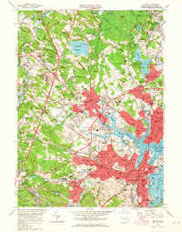
1956 Map of Salem
USGS Topo · Published 1965About this map
The coastal harbor of Salem and its surrounding North Shore industrial towns appear in significant mid-century detail during this mid-1950s survey. Dense urban centers in Peabody City and Beverly City are shown at a time of post-war expansion, with the Newburyport Memorial Highway and numerous interchanges cutting through the landscape. Distinctive cultural landmarks like the House of Seven Gables and Derby Wharf stand on the Salem Harbor waterfront, while the massive footprint of the Danvers State Hospital dominates the western hills near Hathorne. Inland, the landscape retains traces of its agrarian and institutional past, including the County Agricultural Sch and the County Industrial Farm. From the maritime activity at the Salem Terminal Wharf to the quiet grounds of Harmony Grove Cemetery, the map preserves the exact street-level layout and institutional geography of Essex County during a period of rapid suburbanization.
Find a feature on this map
220 named features on this map. Tap any name to fly to it.
Don’t see what you’re looking for? This feature index may not catch every label — zoom into the map to look around manually.
Map Details
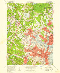
Editions of this 1956 Salem Map
2 editions found
Other maps of this area

1886 · Lawrence
USGS Topo · 1:62,500

1888 · Lawrence
USGS Topo · 1:62,500

1888 · Salem
USGS Topo · 1:62,500

1892 · Boston Bay
USGS Topo · 1:62,500

1893 · Salem
USGS Topo · 1:62,500

1893 · Boston
USGS Topo · 1:62,500

1893 · Lawrence
USGS Topo · 1:62,500

1903 · Boston
USGS Topo · 1:62,500

1903 · Boston Bay
USGS Topo · 1:62,500

1917 · Salem
USGS Topo · 1:62,500