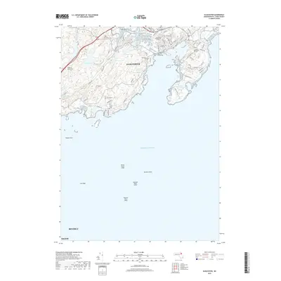
2018 Map of Gloucester
USGS Topo · Published 2018About this map
Gloucester occupies a complex coastline of granite outcrops and tidal inlets on this 2018 survey. The landscape is defined by the transition from the densely settled areas around Southeast Harbor to the inland ponds and hills that characterize the interior of the Cape Ann peninsula. Several significant historic sites are documented, including the First Parish Burial Ground and Mount Pleasant Cem, which speak to the deep genealogical roots of this maritime community. The northern reach of the map features a string of freshwater bodies like Fernwood Lake and the Upper and Lower Banjo Ponds, while the shoreline is punctuated by local landmarks such as Susan Point and the Blynman Drawbridge. Further offshore, the chart includes maritime hazards like Kettle Island Ledge and Naushon Point Shoal, illustrating the continuous relationship between the town and the Atlantic.
Find a feature on this map
96 named features on this map. Tap any name to fly to it.
Don’t see what you’re looking for? This feature index may not catch every label — zoom into the map to look around manually.
Map Details
Editions of this 2018 Gloucester Map
This is the sole edition of this map. No revisions or reprints were ever made.
Other maps of this area

1886 · Gloucester
USGS Topo · 1:62,500

1888 · Gloucester
USGS Topo · 1:62,500

1888 · Salem
USGS Topo · 1:62,500

1892 · Boston Bay
USGS Topo · 1:62,500

1893 · Salem
USGS Topo · 1:62,500

1893 · Gloucester
USGS Topo · 1:62,500

1903 · Boston Bay
USGS Topo · 1:62,500

1917 · Salem
USGS Topo · 1:62,500

1918 · Gloucester
USGS Topo · 1:62,500

1919 · Salem
USGS Topo · 1:62,500