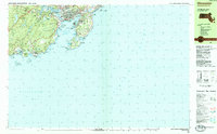
1984 Map of Gloucester
USGS Topo · Published 1984About this map
Gloucester Harbor and the neighboring rocky coastline are documented here in the mid-1980s, revealing a landscape defined by its deep maritime traditions and summer colonies. The map highlights the intricate seafaring infrastructure of the Inner Harbor, including the Coast Guard Station and the Lighthouse at Eastern Point. Inland, the wooded expanse of Ravenswood Park and the elevated terrain of Mount Ann contrast with the dense residential pockets of East Gloucester and the village of Magnolia.
Find a feature on this map
91 named features on this map. Tap any name to fly to it.
Don’t see what you’re looking for? This feature index may not catch every label — zoom into the map to look around manually.
Map Details
Editions of this 1984 Gloucester Map
This is the sole edition of this map. No revisions or reprints were ever made.
Other maps of this area

1886 · Gloucester
USGS Topo · 1:62,500

1888 · Gloucester
USGS Topo · 1:62,500

1888 · Salem
USGS Topo · 1:62,500

1892 · Boston Bay
USGS Topo · 1:62,500

1893 · Salem
USGS Topo · 1:62,500

1893 · Gloucester
USGS Topo · 1:62,500

1903 · Boston Bay
USGS Topo · 1:62,500

1917 · Salem
USGS Topo · 1:62,500

1918 · Gloucester
USGS Topo · 1:62,500

1919 · Salem
USGS Topo · 1:62,500