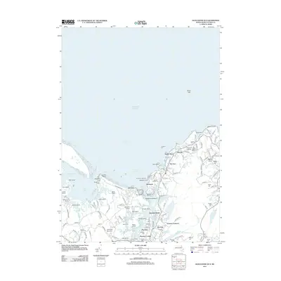
2012 Map of Gloucester OE N
USGS Topo · Published 2012About this map
Annisquam Harbor Light stands as a sentinel over the complex coastline of Cape Ann, where the Annisquam River meets Ipswich Bay. This coastal landscape is defined by its industrial history and maritime orientation, evident in the numerous granite excavations like Gannerys Quarry and Bay State Quarry near Lanesville. The map captures the dense residential pockets of Bay View and Pigeon Cove, alongside recreational areas like Wingaersheek Beach and the YMCA Camp. Local genealogy is well-represented through several established burial grounds, including Mount Adnah Cem and Seaside Cem. The intricate network of tidal flats and islands, such as Pearce Island and Rust Island, illustrates the unique geography of the tidal estuary near Riverview Landing.
Find a feature on this map
130 named features on this map. Tap any name to fly to it.
Don’t see what you’re looking for? This feature index may not catch every label — zoom into the map to look around manually.
Map Details
Editions of this 2012 Gloucester OE N Map
This is the sole edition of this map. No revisions or reprints were ever made.
Other maps of this area

1886 · Gloucester
USGS Topo · 1:62,500

1888 · Newburyport
USGS Topo · 1:62,500

1888 · Gloucester
USGS Topo · 1:62,500

1888 · Salem
USGS Topo · 1:62,500

1890 · Newburyport
USGS Topo · 1:62,500

1893 · Salem
USGS Topo · 1:62,500

1893 · Gloucester
USGS Topo · 1:62,500

1894 · Newburyport
USGS Topo · 1:62,500

1917 · Salem
USGS Topo · 1:62,500

1918 · Gloucester
USGS Topo · 1:62,500