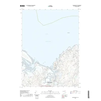
2018 Map of Gloucester OE N
USGS Topo · Published 2018About this map
Gloucester and its intricate northern shoreline are defined by the meeting of the Atlantic Ocean and complex tidal marshlands. The landscape is heavily influenced by the Annisquam River Marshes and Essex Bay Marshes, which create a fragmented coastline of inlets and rocky points. This modern survey illustrates the coastal residential patterns of the late 2010s, where legacy roads like Ye Old Rd and Dogtown Rd connect established neighborhoods to the sea. The area is notable for its high density of burial grounds, including the Wesleyan Cem, Locust Grove Cem, and Seaside Cem, providing a detailed record for genealogists tracing Cape Ann families. Inland, the terrain transitions from the dunes of Coffins Beach to wooded wetland depressions such as Briar Swamp and several small catchments like Sleepy Hollow Pond.
Find a feature on this map
85 named features on this map. Tap any name to fly to it.
Don’t see what you’re looking for? This feature index may not catch every label — zoom into the map to look around manually.
Map Details
Editions of this 2018 Gloucester OE N Map
This is the sole edition of this map. No revisions or reprints were ever made.
Other maps of this area

1886 · Gloucester
USGS Topo · 1:62,500

1888 · Newburyport
USGS Topo · 1:62,500

1888 · Gloucester
USGS Topo · 1:62,500

1888 · Salem
USGS Topo · 1:62,500

1890 · Newburyport
USGS Topo · 1:62,500

1893 · Salem
USGS Topo · 1:62,500

1893 · Gloucester
USGS Topo · 1:62,500

1894 · Newburyport
USGS Topo · 1:62,500

1917 · Salem
USGS Topo · 1:62,500

1918 · Gloucester
USGS Topo · 1:62,500