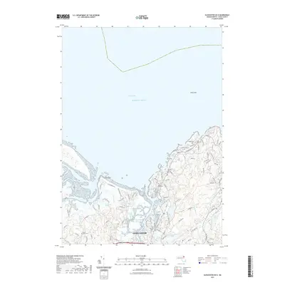
2021 Map of Gloucester OE N
USGS Topo · Published 2021About this map
Gloucester and its intricate coastal geography define this contemporary survey of the North Shore. The map documents the complex network of tidal waterways and wetlands, including the Annisquam River Marshes, Walker Creek Marshes, and Essex River Marshes, which separate the mainland from the sandy expanse of Coffins Beach. Inland, the landscape is characterized by numerous small bodies of water such as Sleepy Hollow Pond, Strangman Pond, and Goose Cove Reservoir.
Find a feature on this map
87 named features on this map. Tap any name to fly to it.
Don’t see what you’re looking for? This feature index may not catch every label — zoom into the map to look around manually.
Map Details
Editions of this 2021 Gloucester OE N Map
This is the sole edition of this map. No revisions or reprints were ever made.
Other maps of this area

1886 · Gloucester
USGS Topo · 1:62,500

1888 · Newburyport
USGS Topo · 1:62,500

1888 · Gloucester
USGS Topo · 1:62,500

1888 · Salem
USGS Topo · 1:62,500

1890 · Newburyport
USGS Topo · 1:62,500

1893 · Salem
USGS Topo · 1:62,500

1893 · Gloucester
USGS Topo · 1:62,500

1894 · Newburyport
USGS Topo · 1:62,500

1917 · Salem
USGS Topo · 1:62,500

1918 · Gloucester
USGS Topo · 1:62,500