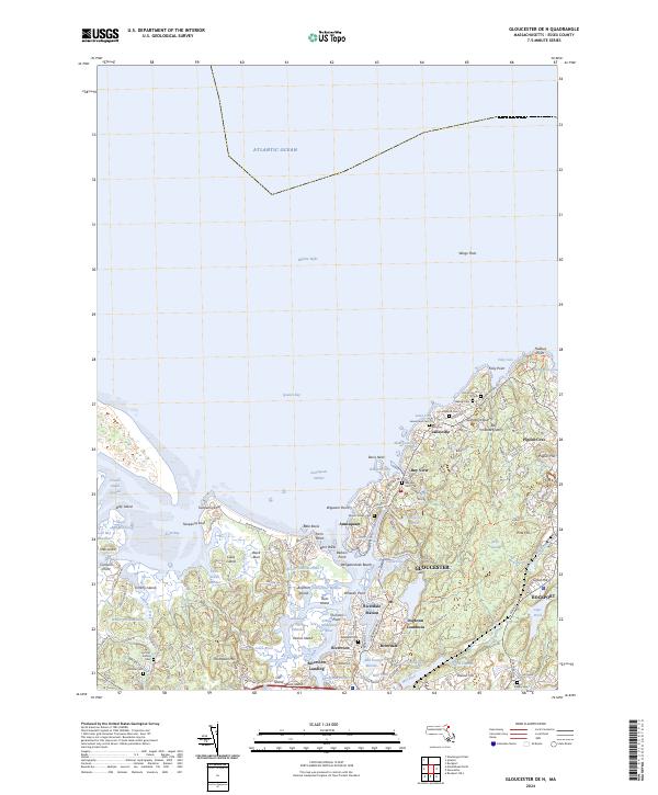
2024 Map of Gloucester OE N
USGS Topo · Published 2024About this map
Gloucester and the coastal settlements of Annisquam, Lanesville, and Pigeon Cove anchor this modern topographic view of Cape Ann. The landscape is defined by the industrial legacy of stone excavation, evidenced by Gannerys Quarry and Bay State Quarry near the coastline. Genealogy researchers can find numerous burial grounds, including Locust Grove Cem, Seaside Cem, and Mount Adnah Cem, which speak to the long-established maritime communities along Ipswich Bay. The intricate shoreline is a mosaic of points and coves like Halibut Point and Plum Cove, while the tidal geography of the Annisquam River creates a complex network of marshes including the Walker Creek Marshes and Farm Creek Marshes. Modern transit corridors such as Washington ST and Main ST connect these historic harbors, while Dogtown Commons and Railcut Hill provide a glimpse into the interior upland terrain that has remained largely undeveloped compared to the densely settled waterfronts of Riverdale and Rockport.
Find a feature on this map
147 named features on this map. Tap any name to fly to it.
Don’t see what you’re looking for? This feature index may not catch every label — zoom into the map to look around manually.
Map Details
Editions of this 2024 Gloucester OE N Map
This is the sole edition of this map. No revisions or reprints were ever made.
Other maps of this area

1886 · Gloucester
USGS Topo · 1:62,500

1888 · Newburyport
USGS Topo · 1:62,500

1888 · Gloucester
USGS Topo · 1:62,500

1888 · Salem
USGS Topo · 1:62,500

1890 · Newburyport
USGS Topo · 1:62,500

1893 · Salem
USGS Topo · 1:62,500

1893 · Gloucester
USGS Topo · 1:62,500

1894 · Newburyport
USGS Topo · 1:62,500

1917 · Salem
USGS Topo · 1:62,500

1918 · Gloucester
USGS Topo · 1:62,500