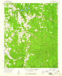
1958 Map of Gold Mine
USGS Topo · Published 1960About this map
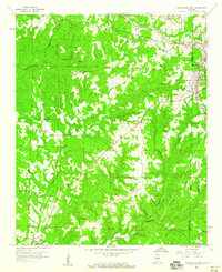
The William B Bankhead National Forest defines the eastern landscape of this survey, where the border of Marion and Winston counties meets the wooded terrain. The land is defined by a network of waterways including the Buttahatchee River, New River, and Bostick Creek, which carved the valleys where small settlements like Whitehouse and Sunny Home took root. The map records a rural economy in transition during the late 1950s, with numerous strip mines and oil wells appearing alongside traditional community landmarks.
Find a feature on this map
38 named features on this map. Tap any name to fly to it.
Don’t see what you’re looking for? This feature index may not catch every label — zoom into the map to look around manually.
Map Details
Editions of this 1958 Gold Mine Map
4 editions found

Other maps of this area

1936 · Delmar
USGS Topo · 1:24,000

1936 · South Of Hackleburg
USGS Topo · 1:24,000

1936 · Goddard
USGS Topo · 1:24,000

1953 · Birmingham
USGS Topo · 1:250,000

1956 · Birmingham
USGS Topo · 1:250,000

1956 · Gadsden
USGS Topo · 1:250,000

1957 · Birmingham
USGS Topo · 1:250,000

1958 · Gadsden
USGS Topo · 1:250,000
1958 · Haleyville East
USGS Topo · 1:24,000
1958 · Haleyville West
USGS Topo · 1:24,000