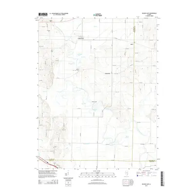
2015 Map of Golden Gate
USGS Topo · Published 2015About this map
Golden Gate and the surrounding rural townships sit at a point where Wayne, Edwards, and White counties converge. This 2015 survey documents a landscape deeply shaped by the serpentine path of the Little Wabash River, which creates a complex network of oxbows and backwaters. The terrain is marked by distinctive water features like Half Moon Pond, Horseshoe Pond, and Old River Pond, indicating an environment where seasonal flooding and river migration have historically dictated land use and settlement patterns.
Find a feature on this map
81 named features on this map. Tap any name to fly to it.
Don’t see what you’re looking for? This feature index may not catch every label — zoom into the map to look around manually.
Map Details
Editions of this 2015 Golden Gate Map
This is the sole edition of this map. No revisions or reprints were ever made.
Other maps of this area

1940 · Carmi
USGS Topo · 1:62,500

1941 · Enfield
USGS Topo · 1:62,500

1943 · Carmi
USGS Topo · 1:62,500

1943 · Albion
USGS Topo · 1:62,500

1944 · Enfield
USGS Topo · 1:62,500

1946 · Albion
USGS Topo · 1:62,500

1948 · Fairfield
USGS Topo · 1:62,500

1958 · Belleville
USGS Topo · 1:250,000

1962 · Belleville
USGS Topo · 1:250,000
1971 · Golden Gate
USGS Topo · 1:24,000