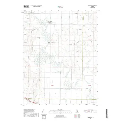
2018 Map of Golden Gate
USGS Topo · Published 2018About this map
The Little Wabash River meanders across this rural landscape at the intersection of Wayne, Edwards, and White counties, shaping a terrain defined by bottomlands and sloughs. Small settlements like Golden Gate and Ellery serve as historical anchors for the region, while the vanished community of Scottsville persists as a place name in the central quadrangle. The river’s influence is evident in the numerous oxbows and backwaters, including Half Moon Pond, Horseshoe Pond, and Hortin Slough, which characterize the floodplain.
Find a feature on this map
64 named features on this map. Tap any name to fly to it.
Don’t see what you’re looking for? This feature index may not catch every label — zoom into the map to look around manually.
Map Details
Editions of this 2018 Golden Gate Map
This is the sole edition of this map. No revisions or reprints were ever made.
Other maps of this area

1940 · Carmi
USGS Topo · 1:62,500

1941 · Enfield
USGS Topo · 1:62,500

1943 · Carmi
USGS Topo · 1:62,500

1943 · Albion
USGS Topo · 1:62,500

1944 · Enfield
USGS Topo · 1:62,500

1946 · Albion
USGS Topo · 1:62,500

1948 · Fairfield
USGS Topo · 1:62,500

1958 · Belleville
USGS Topo · 1:250,000

1962 · Belleville
USGS Topo · 1:250,000
1971 · Golden Gate
USGS Topo · 1:24,000