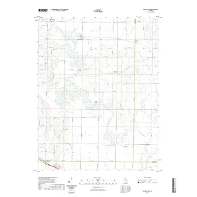
2021 Map of Golden Gate
USGS Topo · Published 2021About this map
The Little Wabash River winds through a landscape of intricate oxbows and bottomland sloughs at the intersection of Wayne, Edwards, and White Counties. This modern topographic record shows a territory defined by its complex hydrology, featuring numerous named water bodies like Half-Moon Pond, Horseshoe Pond, and White Oak Slough. The village of Golden Gate serves as a central hub, surrounded by smaller settlements such as Ellery and Scottsville. Local history is anchored by a significant number of family and community burial grounds, including Wilson Cem, Windland Cem, and Antioch Cem. Historical crossings are clearly identified, with the Old Iron Bridge and Hodgson Bridge spanning the river's shifting channels. The map illustrates how a dense network of county roads has adapted to the drainage patterns of Hortin Slough and the Gum-Road-Ditch, maintaining connectivity between isolated farmsteads and rural townships.
Find a feature on this map
59 named features on this map. Tap any name to fly to it.
Don’t see what you’re looking for? This feature index may not catch every label — zoom into the map to look around manually.
Map Details
Editions of this 2021 Golden Gate Map
This is the sole edition of this map. No revisions or reprints were ever made.
Other maps of this area

1940 · Carmi
USGS Topo · 1:62,500

1941 · Enfield
USGS Topo · 1:62,500

1943 · Carmi
USGS Topo · 1:62,500

1943 · Albion
USGS Topo · 1:62,500

1944 · Enfield
USGS Topo · 1:62,500

1946 · Albion
USGS Topo · 1:62,500

1948 · Fairfield
USGS Topo · 1:62,500

1958 · Belleville
USGS Topo · 1:250,000

1962 · Belleville
USGS Topo · 1:250,000
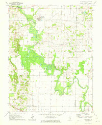
1971 · Golden Gate
USGS Topo · 1:24,000