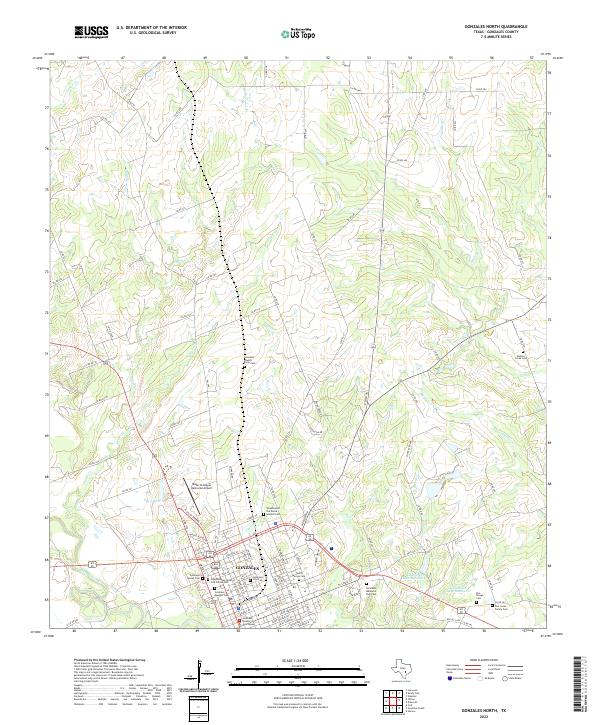
2022 Map of Gonzales North
USGS Topo · Published 2022About this map
The Gonzales townsite sits at a strategic bend where the San Marcos River flows through South Texas, serving as a historic regional hub. This detailed mapping captures the city's complex genealogical landscape, featuring a dense concentration of burial grounds including the Gonzales Jewish Early Cem, the Gonzales Masonic Cem, and the Woodmen of the World Spanish Cem. The downtown area is anchored by the Gonzales County Courthouse, reflecting its role as a seat of local government. North of the city, the landscape transitions into a network of creek drainages such as Smith Cr and Dry Fork, punctuated by small family landmarks like the Dee Jones Family Cem. Modern aviation and water management are represented by the Roger M Dreyer Memorial Airport and the twin reservoirs of Halamicek Lake-Number 1 and Halamicek Lake Number 2.
Find a feature on this map
94 named features on this map. Tap any name to fly to it.
Don’t see what you’re looking for? This feature index may not catch every label — zoom into the map to look around manually.
Map Details
Editions of this 2022 Gonzales North Map
This is the sole edition of this map. No revisions or reprints were ever made.
Other maps of this area

1901 · Flatonia
USGS Topo · 1:125,000

1911 · San Marcos
USGS Topo · 1:125,000

1919 · San Marcos
USGS Topo · 1:125,000

1920 · Smiley
USGS Topo · 1:125,000

1925 · San Marcos 4-a
USGS Topo · 1:48,000

1929 · Luling
USGS Topo · 1:62,500

1953 · Seguin
USGS Topo · 1:250,000

1958 · Seguin
USGS Topo · 1:250,000

1959 · Ottine
USGS Topo · 1:24,000

1959 · Cost
USGS Topo · 1:24,000