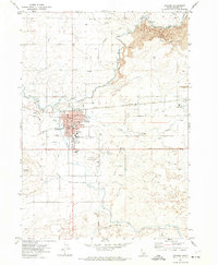
1971 Map of Gooding
USGS Topo · Published 1974About this map
Gooding serves as a hub of civic and educational life in this 1970s landscape, centered on its local Courthouse and the specialized campus of the State School for the Deaf and the Blind. The town is situated at a critical hydraulic junction where the Big Wood River and Little Wood River converge, supported by an extensive network of irrigation infrastructure including the South Gooding Canal, Main Canal, and Union Ditch. This intricate water management system transformed the arid terrain surrounding Gooding Butte into a productive agricultural region.
Find a feature on this map
30 named features on this map. Tap any name to fly to it.
Don’t see what you’re looking for? This feature index may not catch every label — zoom into the map to look around manually.
Map Details
Editions of this 1971 Gooding Map
2 editions found
Other maps of this area

1949 · Gooding Butte
USGS Topo · 1:24,000

1949 · Tuttle
USGS Topo · 1:24,000

1950 · Gooding Butte
USGS Topo · 1:24,000

1951 · Tuttle
USGS Topo · 1:24,000

1955 · Twin Falls
USGS Topo · 1:250,000

1955 · Hailey
USGS Topo · 1:250,000

1957 · Thorn Creek SE
USGS Topo · 1:24,000

1957 · Thorn Creek SW
USGS Topo · 1:24,000

1957 · Thorn Creek
USGS Topo · 1:62,500

1957 · Davis Mountain
USGS Topo · 1:62,500