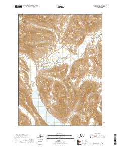
2019 Map of Goodnews Bay C-1 NE
USGS Topo · Published 2019About this map
Lake Nerka and Lake Beverley dominate this high-latitude Alaskan landscape within the Dillingham Census Area. The topography is defined by the elevation changes around Rainbow Basin, where the terrain rises from the lakeshores to significant heights within the sections of T5S and T6S. A distinct arm of Lake Beverley known as Golden Horn reaches into the northeastern quadrant, while Elba Cr feeds into the southwestern waters. The map is a precise record of the public land survey system, illustrating the boundaries of t5s r58w, t5s r57w, t6s r58w, and t6s r57w. This 2019 survey documents a pristine interior wilderness before any modern infrastructure development, preserving the natural hydrological and topographic patterns of the region.
Find a feature on this map
9 named features on this map. Tap any name to fly to it.
Don’t see what you’re looking for? This feature index may not catch every label — zoom into the map to look around manually.
Map Details
Editions of this 2019 Goodnews Bay C-1 NE Map
This is the sole edition of this map. No revisions or reprints were ever made.
Other maps of this area

1951 · Dillingham
USGS Topo · 1:250,000

1951 · Goodnews
USGS Topo · 1:250,000

1954 · Dillingham
USGS Topo · 1:250,000

1954 · Dillingham D-8
USGS Topo · 1:63,360

1954 · Dillingham C-8
USGS Topo · 1:63,360

1979 · Goodnews Bay D-1
USGS Topo · 1:63,360

1979 · Goodnews Bay
USGS Topo · 1:250,000

1979 · Goodnews Bay C-1
USGS Topo · 1:63,360
2019 · Dillingham C-8 NW
USGS Topo · 1:25,000
2019 · Dillingham D-8 SW
USGS Topo · 1:25,000