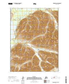
2019 Map of Goodnews Bay C-2 NE
USGS Topo · Published 2019About this map
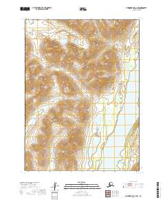
The Wood River Mountains dominate this high-latitude terrain, where deep glacial valleys and steep ridgelines shape the landscape of southwest Alaska. In the northwest corner, the clear waters of Togiak Lake meet the land at North Spit, serving as a critical geographic marker for the drainage system that includes the Izavieknik River. This river system and the winding course of Sunday Creek illustrate the intricate hydrology of the Dillingham Census Area. The map captures a wilderness largely defined by its natural topography rather than human infrastructure, offering a precise look at the township and range boundaries of t5s r60w and t6s r60w as they were surveyed in the early twenty-first century. It is a valuable record for those studying the hydrologic patterns and land divisions of this subarctic environment.
Find a feature on this map
10 named features on this map. Tap any name to fly to it.
Don’t see what you’re looking for? This feature index may not catch every label — zoom into the map to look around manually.
Map Details
Editions of this 2019 Goodnews Bay C-2 NE Map
This is the sole edition of this map. No revisions or reprints were ever made.
Other maps of this area

1951 · Goodnews
USGS Topo · 1:250,000

1954 · Goodnews C-2
USGS Topo · 1:63,360

1979 · Goodnews Bay D-1
USGS Topo · 1:63,360

1979 · Goodnews Bay
USGS Topo · 1:250,000

1979 · Goodnews Bay C-1
USGS Topo · 1:63,360

1979 · Goodnews Bay D-2
USGS Topo · 1:63,360
2019 · Goodnews Bay C-2 SE
USGS Topo · 1:25,000
2019 · Goodnews Bay C-2 SW
USGS Topo · 1:25,000
2019 · Goodnews Bay C-1 SW
USGS Topo · 1:25,000
2019 · Goodnews Bay C-2 NW
USGS Topo · 1:25,000