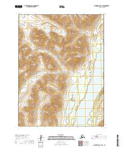
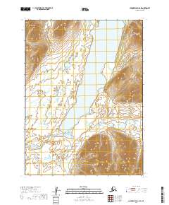
2019 Map of Goodnews Bay C-2 NW
USGS Topo · Published 2019About this map
Ahklun Mountains dominate this 2019 survey of the Alaskan interior, north of Goodnews Bay. The landscape is defined by its drainage systems, where glacial and snowmelt runoff flows through Kipnuktuli Cr and Ongamantuk Cr. These watercourses feed into the significant bodies of Togiak Lake and West Togiak Lake along the eastern edge of the quadrangle. The elevation reaches a distinct summit at Pistuk Peak in the north, surrounded by a network of seasonal streams like Sand Cr. This map illustrates the hydrology and high-elevation topography of the Dillingham Census Area, showing the natural transition from mountain peaks to the vast lake basins that characterize this part of the Alaskan wilderness.
Find a feature on this map
13 named features on this map. Tap any name to fly to it.
Don’t see what you’re looking for? This feature index may not catch every label — zoom into the map to look around manually.
Map Details
Editions of this 2019 Goodnews Bay C-2 NW Map
This is the sole edition of this map. No revisions or reprints were ever made.
Other maps of this area

1951 · Goodnews
USGS Topo · 1:250,000

1954 · Goodnews C-2
USGS Topo · 1:63,360

1979 · Goodnews Bay D-3
USGS Topo · 1:63,360

1979 · Goodnews Bay C-3
USGS Topo · 1:63,360

1979 · Goodnews Bay
USGS Topo · 1:250,000

1979 · Goodnews Bay D-2
USGS Topo · 1:63,360
2019 · Goodnews Bay C-3 SE
USGS Topo · 1:25,000
2019 · Goodnews Bay D-3 SE
USGS Topo · 1:25,000
2019 · Goodnews Bay C-2 SE
USGS Topo · 1:25,000
2019 · Goodnews Bay C-2 SW
USGS Topo · 1:25,000