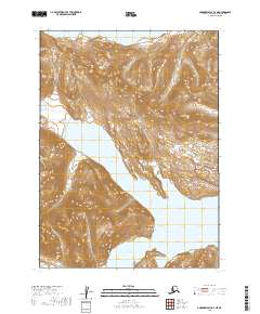
2019 Map of Goodnews Bay D-1 NE
USGS Topo · Published 2019About this map
Lake Chauekuktuli dominates the northern reaches of this Alaskan landscape, part of a complex freshwater system in the Dillingham Census Area. The terrain is defined by the significant intersection of water and high ground, where the Portage Arm of Nuyakuk Lake reaches westward toward the Red Hills. This 2019 survey documents the intricate shoreline of the Wood-Tikchik area, including the sheltered waters of Shadow Bay and Mirror Bay. The map provides a precise record of the elevation and hydrology in this unpopulated wilderness, illustrating the narrow land bridges and steep contours that separate these vast glacial lakes. The absence of roads or established settlements emphasizes the pristine nature of the region as it remained in the early 21st century, documented by the U.S. Geological Survey through modern satellite imagery and topographic data.
Find a feature on this map
10 named features on this map. Tap any name to fly to it.
Don’t see what you’re looking for? This feature index may not catch every label — zoom into the map to look around manually.
Map Details
Editions of this 2019 Goodnews Bay D-1 NE Map
This is the sole edition of this map. No revisions or reprints were ever made.
Other maps of this area

1950 · Bethel
USGS Topo · 1:250,000

1950 · Taylor Mountains
USGS Topo · 1:250,000

1951 · Taylor Mountains
USGS Topo · 1:250,000

1951 · Dillingham
USGS Topo · 1:250,000

1951 · Goodnews
USGS Topo · 1:250,000

1954 · Taylor Mountains
USGS Topo · 1:250,000

1954 · Dillingham
USGS Topo · 1:250,000

1954 · Taylor Mountains A-8
USGS Topo · 1:63,360

1954 · Dillingham D-8
USGS Topo · 1:63,360

1979 · Bethel A-1
USGS Topo · 1:63,360