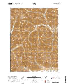
2019 Map of Goodnews Bay D-1 NW
USGS Topo · Published 2019About this map
The Nuyakuk River and Kukaktlik River define the lower drainage patterns of this Alaskan landscape, captured in a 2019 survey of the Dillingham Census Area. This region is characterized by steep elevation shifts and an absence of modern infrastructure, with the map focusing on the natural topographical contours rather than human settlements. The boundary markers for T2s R59w and T3s R58w delineate the vast township and range sections that organize this part of the interior.
Find a feature on this map
6 named features on this map. Tap any name to fly to it.
Don’t see what you’re looking for? This feature index may not catch every label — zoom into the map to look around manually.
Map Details
Editions of this 2019 Goodnews Bay D-1 NW Map
This is the sole edition of this map. No revisions or reprints were ever made.
Other maps of this area

1950 · Bethel
USGS Topo · 1:250,000

1951 · Goodnews
USGS Topo · 1:250,000

1979 · Bethel A-1
USGS Topo · 1:63,360

1979 · Bethel A-2
USGS Topo · 1:63,360

1979 · Goodnews Bay D-1
USGS Topo · 1:63,360

1979 · Goodnews Bay
USGS Topo · 1:250,000

1979 · Goodnews Bay D-2
USGS Topo · 1:63,360

1980 · Bethel
USGS Topo · 1:250,000
2019 · Bethel A-1 SW
USGS Topo · 1:25,000
2019 · Bethel A-1 SE
USGS Topo · 1:25,000