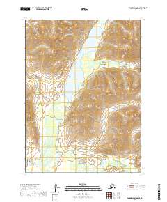
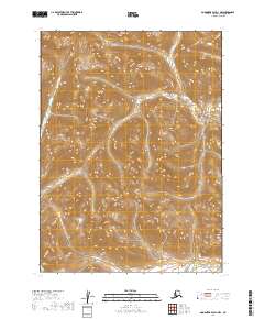
2019 Map of Goodnews Bay D-2 SE
USGS Topo · Published 2019About this map
Upper Togiak Lake dominates the central landscape of this wilderness region, serving as a primary hydrologic hub for the Izavieknik River. The river flows both north and south from the lake's boundaries, cutting through the high elevations of the Wood River Mountains. This 2019 survey captures a remote Alaskan environment defined entirely by its natural water systems and topographical relief, with Trail Cr feeding into the river system from the west. The absence of roads or permanent settlements within these townships emphasizes the area's role as a pristine corridor for water transit and ecological study within the Dillingham Census Area.
Find a feature on this map
10 named features on this map. Tap any name to fly to it.
Don’t see what you’re looking for? This feature index may not catch every label — zoom into the map to look around manually.
Map Details
Editions of this 2019 Goodnews Bay D-2 SE Map
This is the sole edition of this map. No revisions or reprints were ever made.
Other maps of this area

1951 · Goodnews
USGS Topo · 1:250,000

1954 · Goodnews C-2
USGS Topo · 1:63,360

1979 · Goodnews Bay D-1
USGS Topo · 1:63,360

1979 · Goodnews Bay
USGS Topo · 1:250,000

1979 · Goodnews Bay C-1
USGS Topo · 1:63,360

1979 · Goodnews Bay D-2
USGS Topo · 1:63,360
2019 · Goodnews Bay D-2 NW
USGS Topo · 1:25,000
2019 · Goodnews Bay C-2 NW
USGS Topo · 1:25,000
2019 · Goodnews Bay C-2 NE
USGS Topo · 1:25,000
2019 · Goodnews Bay D-1 NW
USGS Topo · 1:25,000