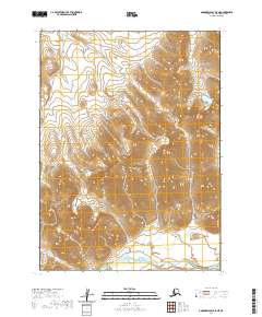
2020 Map of Goodnews Bay D-5 NE
USGS Topo · Published 2020About this map
The Eek Mountains dominate this high-latitude terrain within the Bethel Census Area, showcasing the dramatic elevation changes of the Alaskan wilderness. The southern reaches of the quadrangle are defined by the broad path of the Kanektok River, which flows westward toward the coast. Along the western edge, the smaller drainage of Nakailingak Cr cuts through the steep slopes. This landscape is largely defined by its natural drainage patterns and the absence of established road infrastructure or settlements, reflecting a region where access is governed by the rivers and mountain passes. The map provides a precise layout of the Public Land Survey System divisions, including sections of t2s r66w and t3s r66w, which are essential for identifying specific land tracts in this remote interior.
Find a feature on this map
7 named features on this map. Tap any name to fly to it.
Don’t see what you’re looking for? This feature index may not catch every label — zoom into the map to look around manually.
Map Details
Editions of this 2020 Goodnews Bay D-5 NE Map
This is the sole edition of this map. No revisions or reprints were ever made.
Other maps of this area

1950 · Bethel
USGS Topo · 1:250,000

1951 · Goodnews
USGS Topo · 1:250,000

1954 · Bethel A-5
USGS Topo · 1:63,360

1954 · Bethel A-4
USGS Topo · 1:63,360

1954 · Goodnews D-4
USGS Topo · 1:63,360

1954 · Goodnews D-5
USGS Topo · 1:63,360

1979 · Goodnews Bay
USGS Topo · 1:250,000

1980 · Bethel
USGS Topo · 1:250,000
2017 · Bethel A-5 SE
USGS Topo · 1:25,000
2017 · Bethel A-5 SW
USGS Topo · 1:25,000