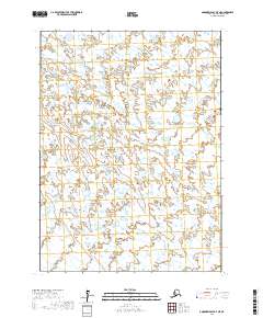
2017 Map of Goodnews Bay D-7 NE
USGS Topo · Published 2017About this map
Hydrological systems define this portion of the Bethel Census Area, where the winding course of the Ulukluk River dominates the northern landscape. This 2017 survey illustrates a complex network of wetlands and tundra ponds typical of the coastal Alaskan environment near Goodnews Bay. Moving toward the southern reaches of the map, the Klukluk Cr carves a path through the low-lying terrain, providing a look at the natural drainage patterns in an area largely defined by its lack of human infrastructure or roads. The map serves as a vital record of the shifting water bodies in this remote region, documenting the intricate boundary lines between townships such as t2s r71w and t2s r70w, which organize this otherwise undisturbed wilderness.
Find a feature on this map
6 named features on this map. Tap any name to fly to it.
Don’t see what you’re looking for? This feature index may not catch every label — zoom into the map to look around manually.
Map Details
Editions of this 2017 Goodnews Bay D-7 NE Map
This is the sole edition of this map. No revisions or reprints were ever made.
Other maps of this area

1950 · Bethel
USGS Topo · 1:250,000

1951 · Goodnews
USGS Topo · 1:250,000

1954 · Bethel A-7
USGS Topo · 1:63,360

1954 · Goodnews D-6
USGS Topo · 1:63,360

1954 · Goodnews D-7
USGS Topo · 1:63,360

1954 · Bethel A-6
USGS Topo · 1:63,360
1964 · Bethel A-6
USGS Topo · 1:63,360

1979 · Goodnews Bay
USGS Topo · 1:250,000

1980 · Bethel
USGS Topo · 1:250,000
2017 · Bethel A-7 SW
USGS Topo · 1:25,000