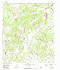
1962 Map of Goodwill
USGS Topo · Published 1989About this map
The Brazos R winds through the northeast corner of this map, defining the border between Milam and Robertson counties in a landscape of complex creek drainages. The rural settlement of Hix serves as a central landmark for this upland area, supported by the Hix Cem and nearby Macedonia Ch. The terrain is deeply dissected by numerous family-named and descriptive waterways, including Sixmile Creek, Pigeon Branch, and Whiskey Hollow, which drain toward the river basin.
Find a feature on this map
35 named features on this map. Tap any name to fly to it.
Don’t see what you’re looking for? This feature index may not catch every label — zoom into the map to look around manually.
Map Details
Editions of this 1962 Goodwill Map
2 editions found
Other maps of this area

1954 · Austin
USGS Topo · 1:250,000

1956 · Caldwell
USGS Topo · 1:62,500

1956 · Milano
USGS Topo · 1:62,500
1961 · Caldwell
USGS Topo · 1:24,000

1961 · Mumford
USGS Topo · 1:24,000

1961 · Hanover
USGS Topo · 1:24,000

1961 · Hearne South
USGS Topo · 1:24,000

1962 · Goodwill
USGS Topo · 1:24,000
1962 · Chriesman
USGS Topo · 1:24,000
1962 · Tunis
USGS Topo · 1:24,000