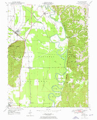
1947 Map of Gorham
USGS Topo · Published 1976About this map
Big Muddy River winds in dramatic loops through the center of this landscape, carving deep bends such as Horseshoe Bend and Mill Bend as it approaches its confluence with the Mississippi. The terrain is defined by a stark contrast between the low-lying Oakwood Bottoms and the prominent rising massif of Fountain Bluff, which reaches an elevation notable enough for the Fountain Bluff Lookout Tower. Small settlements like Gorham and Grand Tower serve as anchors for the local community, while vanished rail stops and sidings like Johns Spur and Fountain Bluff Station mark the paths of the Missouri Pacific and Illinois Central railroads.
Find a feature on this map
53 named features on this map. Tap any name to fly to it.
Don’t see what you’re looking for? This feature index may not catch every label — zoom into the map to look around manually.
Map Details
Editions of this 1947 Gorham Map
4 editions found
Other maps of this area

1910 · Murphysboro
USGS Topo · 1:62,500

1916 · Campbell Hill
USGS Topo · 1:62,500

1918 · Altenburg
USGS Topo · 1:62,500

1918 · Campbell Hill
USGS Topo · 1:62,500

1924 · Alto Pass
USGS Topo · 1:62,500

1925 · Altenburg
USGS Topo · 1:62,500

1938 · Murphysboro
USGS Topo · 1:62,500

1947 · Alto Pass
USGS Topo · 1:62,500

1947 · Gorham
USGS Topo · 1:24,000
1947 · Wolf Lake
USGS Topo · 1:24,000