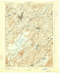
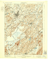
1908 Map of Goshen
USGS Topo · Published 1925About this map
Middletown and Goshen serve as the primary hubs in this early twentieth-century portrait of Orange County, where a dense network of iron rails defines the local economy. The landscape is heavily marked by the routes of the Erie RR, the New York Ontario and Western RR, and the Lehigh and Hudson River RR, which converged here to transport agricultural goods and passengers across the region.
Find a feature on this map
102 named features on this map. Tap any name to fly to it.
Don’t see what you’re looking for? This feature index may not catch every label — zoom into the map to look around manually.
Map Details
Editions of this 1908 Goshen Map
6 editions found

Other maps of this area

1888 · Franklin
USGS Topo · 1:62,500

1891 · Greenwood Lake
USGS Topo · 1:62,500

1891 · Ramapo
USGS Topo · 1:62,500

1893 · Greenwood Lake
USGS Topo · 1:62,500

1893 · Ramapo
USGS Topo · 1:62,500

1894 · Franklin
USGS Topo · 1:62,500

1897 · Franklin
USGS Topo · 1:62,500

1902 · Schunemunk
USGS Topo · 1:62,500

1903 · Newburg
USGS Topo · 1:62,500

1903 · Franklin Furnace
USGS Topo · 1:62,500