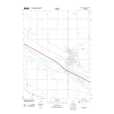
2011 Map of Gothenburg
USGS Topo · Published 2011About this map
Gothenburg serves as the central hub for this agricultural landscape, situated along the northern banks of the Platte River. The town is defined by its recreational and memorial sites, including Lake Helen, Lafayette Park, and the Veterans War Memorial. The surrounding countryside reveals an intricate network of irrigation systems vital to the region's farming, featuring the Gothenburg Canal, Sixmile Canal, and the Thirtymile Canal. Genealogists will find several burial grounds across the territory, from the Gothenburg Cemetery near town to the more outlying Salem Cemetery, Christ Cemetery, and Peckham Cemetery. To the north, the terrain shifts into Wild Horse Valley, while the Krone Reservoir and its associated Krone Dam manage water resources north of the settlement. This survey documents the complex water management infrastructure that allows for productivity in the Nebraska plains.
Find a feature on this map
53 named features on this map. Tap any name to fly to it.
Don’t see what you’re looking for? This feature index may not catch every label — zoom into the map to look around manually.
Map Details
Editions of this 2011 Gothenburg Map
This is the sole edition of this map. No revisions or reprints were ever made.
Other maps of this area

1902 · Gothenburg
USGS Topo · 1:125,000

1954 · McCook
USGS Topo · 1:250,000

1954 · North Platte
USGS Topo · 1:250,000

1956 · North Platte
USGS Topo · 1:250,000

1957 · North Platte
USGS Topo · 1:250,000

1957 · McCook
USGS Topo · 1:250,000

1958 · McCook
USGS Topo · 1:250,000

1967 · North Platte
USGS Topo · 1:250,000
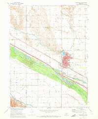
1970 · Gothenburg
USGS Topo · 1:24,000
1970 · Jeffrey Reservoir SE
USGS Topo · 1:24,000