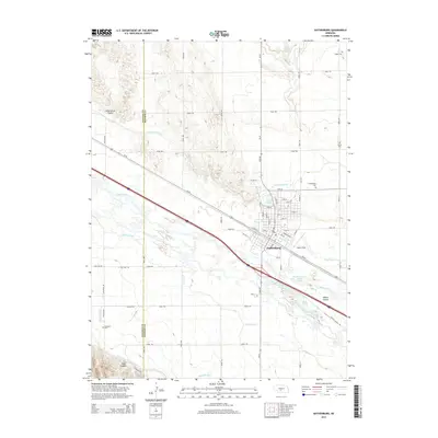
2014 Map of Gothenburg
USGS Topo · Published 2014About this map
Gothenburg serves as the central hub of this Platte River valley landscape, defined by an intricate network of irrigation and power channels. The Platte River and its North Channel are flanked by numerous man-made waterways, including the Gothenburg Canal, Cozad Canal, Sixmile Canal, and the large-scale Tri-County Supply Canal. This sophisticated water management system supports the agricultural economy of the region, visible in the transition from the rugged terrain of Wild Horse Valley and Tree Canyon in the north and south to the leveled valley floor. For genealogists and local historians, several rural burial grounds are mapped across the quadrangle, such as Salem Cem, Christ Cem, and Peckham Cem. Significant local landmarks like Lake Helen and Quinn Field provide a detailed look at the town's recreational and civic footprint during this era of 21st-century development.
Find a feature on this map
48 named features on this map. Tap any name to fly to it.
Don’t see what you’re looking for? This feature index may not catch every label — zoom into the map to look around manually.
Map Details
Editions of this 2014 Gothenburg Map
This is the sole edition of this map. No revisions or reprints were ever made.
Other maps of this area
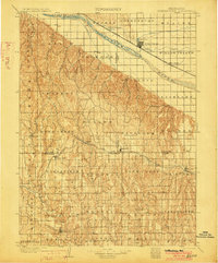
1902 · Gothenburg
USGS Topo · 1:125,000
1954 · McCook
USGS Topo · 1:250,000
1954 · North Platte
USGS Topo · 1:250,000
1956 · North Platte
USGS Topo · 1:250,000
1957 · North Platte
USGS Topo · 1:250,000
1957 · McCook
USGS Topo · 1:250,000
1958 · McCook
USGS Topo · 1:250,000
1967 · North Platte
USGS Topo · 1:250,000
1970 · Gothenburg
USGS Topo · 1:24,000
1970 · Jeffrey Reservoir SE
USGS Topo · 1:24,000