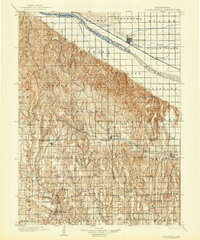
1902 Map of Gothenburg
USGS Topo · Published 1942About this map
Platte River valley life at the turn of the century centers on the heavy industrial corridor of the Union Pacific railroad and early irrigation developments like the Cozad Canal and Main Line Canal. North of the river, the landscape of Gothenburg is defined by its proximity to Helen Lake and the fertile bottomlands, while to the south, the terrain breaks into a dense network of canyons, including Cottonwood Canyon and Gaslin Canyon.
Find a feature on this map
56 named features on this map. Tap any name to fly to it.
Don’t see what you’re looking for? This feature index may not catch every label — zoom into the map to look around manually.
Map Details
Editions of this 1902 Gothenburg Map
3 editions found
Other maps of this area

1896 · Lexington
USGS Topo · 1:125,000

1896 · Arapahoe
USGS Topo · 1:125,000

1898 · Arapahoe
USGS Topo · 1:125,000

1899 · Lexington
USGS Topo · 1:125,000

1899 · North Platte
USGS Topo · 1:125,000

1902 · Gothenburg
USGS Topo · 1:125,000

1902 · North Platte
USGS Topo · 1:125,000

1951 · Oconto SW
USGS Topo · 1:24,000

1954 · McCook
USGS Topo · 1:250,000

1954 · North Platte
USGS Topo · 1:250,000