
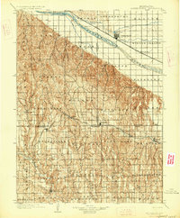
1902 Map of Gothenburg
USGS Topo · Published 1902About this map
The Platte River corridor serves as the primary artery of commerce and settlement on this 1902 survey, where the Union Pacific railroad tracks parallel the water and a complex network of irrigation canals. The town of Gothenburg and the settlement of Cozad anchor the northern plains, while the rugged canyon country to the south is defined by deep incisions like Cottonwood Canyon and Jeffrey Canyon. This landscape reflects a period of intensive land division, where townships such as Antelope, Peckham, and Keystone were being carved out of the Nebraska prairie.
Find a feature on this map
64 named features on this map. Tap any name to fly to it.
Don’t see what you’re looking for? This feature index may not catch every label — zoom into the map to look around manually.
Map Details
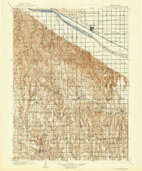
Editions of this 1902 Gothenburg Map
3 editions found
Other maps of this area

1896 · Lexington
USGS Topo · 1:125,000

1896 · Arapahoe
USGS Topo · 1:125,000

1898 · Arapahoe
USGS Topo · 1:125,000

1899 · Lexington
USGS Topo · 1:125,000

1899 · North Platte
USGS Topo · 1:125,000

1902 · North Platte
USGS Topo · 1:125,000

1951 · Oconto SW
USGS Topo · 1:24,000

1954 · McCook
USGS Topo · 1:250,000

1954 · North Platte
USGS Topo · 1:250,000

1955 · Broken Bow
USGS Topo · 1:250,000