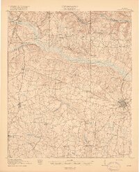
1919 Map of Gough
USGS Topo · Published 1919About this map
Waynesboro serves as the primary hub for this rural Georgia landscape, situated at the junction of the Georgia and Florida and the Savannah and Atlanta railroads. The map reveals a dense network of early 20th-century rural education and faith, featuring numerous local landmarks such as Boggs Academy, Noah's Ark School, and Hopeful Church. This 1918 survey documents a region defined by its reliance on water and rail, with Storys Mill positioned on McBean Creek near the Richmond and Burke County line.
Find a feature on this map
54 named features on this map. Tap any name to fly to it.
Don’t see what you’re looking for? This feature index may not catch every label — zoom into the map to look around manually.
Map Details
Editions of this 1919 Gough Map
3 editions found
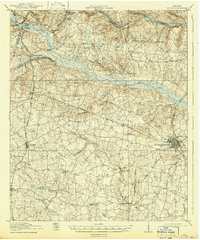
Other maps of this area

1919 · Gough
USGS Topo · 1:62,500

1920 · Stapleton
USGS Topo · 1:62,500

1920 · Millen
USGS Topo · 1:62,500

1920 · Greens Cut
USGS Topo · 1:62,500

1921 · Augusta
USGS Topo · 1:62,500

1922 · Harlem
USGS Topo · 1:62,500

1922 · Hephzibah
USGS Topo · 1:62,500

1943 · Greens Cut
USGS Topo · 1:62,500

1943 · Millen
USGS Topo · 1:62,500

1943 · Augusta East
USGS Topo · 1:125,000