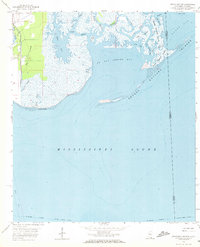
1958 Map of Grand Bay SW
USGS Topo · Published 1972About this map
The coastal marshlands of Jackson County at the Mississippi-Alabama border are defined by an intricate network of tidal bayous and expansive shallow bays. Stretching along the northwestern edge, the Louisville and Nashville railroad provides the primary industrial artery for the region, running adjacent to the Jackson County Airport. The landscape transitions from the open waters of the Mississippi Sound to protected estuaries like Pt aux Chenes Bay and Grand Bay.
Find a feature on this map
31 named features on this map. Tap any name to fly to it.
Don’t see what you’re looking for? This feature index may not catch every label — zoom into the map to look around manually.
Map Details
Editions of this 1958 Grand Bay SW Map
3 editions found
Other maps of this area

1921 · Grand Bay
USGS Topo · 1:62,500

1921 · Petit Bois Island
USGS Topo · 1:62,500

1941 · Horn Island
USGS Topo · 1:62,500

1942 · Petit Bois Island
USGS Topo · 1:62,500

1942 · Horn Island
USGS Topo · 1:62,500

1943 · Pascagoula
USGS Topo · 1:62,500

1943 · Grand Bay
USGS Topo · 1:62,500

1953 · Mobile
USGS Topo · 1:250,000

1955 · Pascagoula
USGS Topo · 1:62,500

1957 · Mobile
USGS Topo · 1:250,000