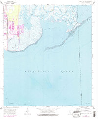
1958 Map of Grand Bay SW
USGS Topo · Published 1978About this map
The Prairie and the intricate marshlands of the Mississippi-Alabama border define this coastal environment during the mid-20th century. The landscape is dominated by a complex network of waterways, including Bangs Lake and numerous tidal channels like Cumbest Bayou, Crooked Bayou, and Jose Bayou. A striking geographical feature is the Grande Batture, a narrow landform protecting the inner marshes from the open Mississippi Sound. Industrial and infrastructure development is evident on the western edge near Pt aux Chenes, where a substation, towers, and tailings ponds appear alongside the Jackson County Airport. This map illustrates the natural transition between the mainland and the islands of the Gulf, documenting the shoreline before later coastal changes. Navigational markers include the Intracoastal Waterway and a designated cable area in the southern waters.
Find a feature on this map
34 named features on this map. Tap any name to fly to it.
Don’t see what you’re looking for? This feature index may not catch every label — zoom into the map to look around manually.
Map Details
Editions of this 1958 Grand Bay SW Map
3 editions found
Other maps of this area

1921 · Grand Bay
USGS Topo · 1:62,500

1921 · Petit Bois Island
USGS Topo · 1:62,500

1941 · Horn Island
USGS Topo · 1:62,500

1942 · Petit Bois Island
USGS Topo · 1:62,500

1942 · Horn Island
USGS Topo · 1:62,500

1943 · Pascagoula
USGS Topo · 1:62,500

1943 · Grand Bay
USGS Topo · 1:62,500

1953 · Mobile
USGS Topo · 1:250,000

1955 · Pascagoula
USGS Topo · 1:62,500

1957 · Mobile
USGS Topo · 1:250,000