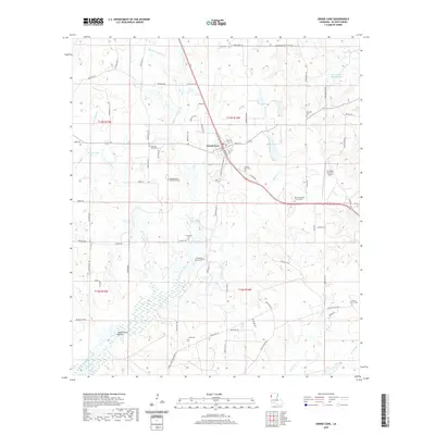
2020 Map of Grand Cane
USGS Topo · Published 2020About this map
Grand Cane serves as the central hub of this DeSoto Parish landscape, where the local street grid including W Main St and Holly St meets the Grand Cane Logansport Rd. The surrounding terrain is defined by an intricate network of waterways, most notably Bayou Grand Cane and the expansive Southerland Bottom to the south. This area is particularly dense with sites of genealogical importance, featuring numerous burial grounds such as the Neighborhood Old Burial Cem and the Mary Evergreen Church Cem. To the east, the C E 'Rusty' Williams Airport provides a modern landmark among the traditional parish roads. The map reveals a land structured by a mix of early transit routes like Stagecoach Rd and rural family landmarks like the Frazier Family Cem, reflecting a long history of settlement along the bayous.
Find a feature on this map
83 named features on this map. Tap any name to fly to it.
Don’t see what you’re looking for? This feature index may not catch every label — zoom into the map to look around manually.
Map Details
Editions of this 2020 Grand Cane Map
This is the sole edition of this map. No revisions or reprints were ever made.
Other maps of this area

1941 · Pelican
USGS Topo · 1:62,500

1943 · Pleasant Hill
USGS Topo · 1:62,500

1944 · Logansport
USGS Topo · 1:62,500

1944 · Pleasant Hill
USGS Topo · 1:62,500

1945 · Grand Cane
USGS Topo · 1:62,500

1945 · Mansfield
USGS Topo · 1:62,500

1947 · Mansfield
USGS Topo · 1:62,500

1953 · Alexandria
USGS Topo · 1:250,000

1955 · Shreveport
USGS Topo · 1:250,000

1955 · Alexandria
USGS Topo · 1:250,000