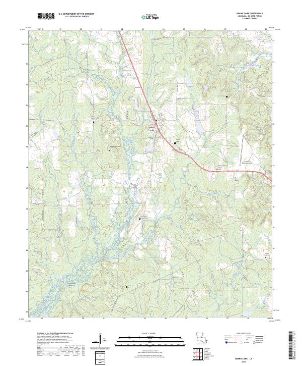
2024 Map of Grand Cane
USGS Topo · Published 2024About this map
Grand Cane serves as the central hub of this De Soto Parish landscape, where the Union Pacific railroad corridor dictates the local geography. The area is defined by a dense concentration of historical burial sites and rural congregations, reflecting generations of family settlement. Genealogists can find specifically named sites such as the Frazier Family Cem, Cook Cem, and the Neighborhood Old Burial Cem. The terrain transitions from the elevations of Honey Dew Hill down into the riparian environment of Southerland Bottom, drained by a network of waterways including Bayou Grand Cane and Wallace Creek. Regional infrastructure is well-marked, from the C E 'Rusty' Williams Airport to the Grand Cane Firetower Rd, illustrating the modern management of these timbered Louisiana lands alongside established landmarks like Old Zion Church and Mary Evergreen Church.
Find a feature on this map
84 named features on this map. Tap any name to fly to it.
Don’t see what you’re looking for? This feature index may not catch every label — zoom into the map to look around manually.
Map Details
Editions of this 2024 Grand Cane Map
This is the sole edition of this map. No revisions or reprints were ever made.
Other maps of this area

1941 · Pelican
USGS Topo · 1:62,500

1943 · Pleasant Hill
USGS Topo · 1:62,500

1944 · Logansport
USGS Topo · 1:62,500

1944 · Pleasant Hill
USGS Topo · 1:62,500

1945 · Grand Cane
USGS Topo · 1:62,500

1945 · Mansfield
USGS Topo · 1:62,500

1947 · Mansfield
USGS Topo · 1:62,500

1953 · Alexandria
USGS Topo · 1:250,000

1955 · Shreveport
USGS Topo · 1:250,000

1955 · Alexandria
USGS Topo · 1:250,000