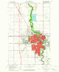
1963 Map of Grand Forks
USGS Topo · Published 1965About this map
The University of North Dakota and its surrounding college community anchor the western portion of this mid-century Red River Valley landscape. The meandering Red River of the North serves as the central spine of the area, separating Grand Forks from East Grand Forks. The map reveals a robust educational and religious infrastructure, including several parochial institutions like Sacred Heart Sch and St Michael Sch, alongside public facilities like Central High Sch.
Find a feature on this map
86 named features on this map. Tap any name to fly to it.
Don’t see what you’re looking for? This feature index may not catch every label — zoom into the map to look around manually.
Map Details
Editions of this 1963 Grand Forks Map
2 editions found
Other maps of this area

1918 · Warren
USGS Topo · 1:62,500

1934 · Grand Forks
USGS Topo · 1:24,000

1934 · Grand Forks
USGS Topo · 1:62,500

1938 · Grand Forks
USGS Topo · 1:62,500

1952 · Grand Forks
USGS Topo · 1:250,000

1952 · Thief River Falls
USGS Topo · 1:250,000

1955 · Warren
USGS Topo · 1:62,500

1956 · Thief River Falls
USGS Topo · 1:250,000

1956 · Grand Forks
USGS Topo · 1:250,000

1957 · Thief River Falls
USGS Topo · 1:250,000