
1958 Map of Grand Rapids
USGS Topo · Published 1973About this map
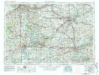
Industrial and transportation corridors define this late-1950s landscape, anchored by the major urban centers of Grand Rapids, Lansing, and Kalamazoo. The expansion of the postwar interstate system is evident in the paths of I-96 and I-94, which cut through the agricultural heartland and connect smaller manufacturing hubs like Battle Creek and Jackson. This period of growth is balanced by extensive public lands, including the Fort Custer Military Reservation and sprawling natural tracts like the Allegan State Forest and Yankee Springs State Rec Area.
Find a feature on this map
178 named features on this map. Tap any name to fly to it.
Don’t see what you’re looking for? This feature index may not catch every label — zoom into the map to look around manually.
Map Details
Editions of this 1958 Grand Rapids Map
2 editions found
Other maps of this area

1902 · Dexter
USGS Topo · 1:62,500

1904 · Ann Arbor
USGS Topo · 1:125,000

1906 · Dexter
USGS Topo · 1:62,500

1906 · Saline
USGS Topo · 1:62,500

1907 · Howell
USGS Topo · 1:62,500

1908 · Ann Arbor
USGS Topo · 1:125,000

1908 · Fowlerville
USGS Topo · 1:62,500

1909 · Howell
USGS Topo · 1:62,500

1909 · Mason
USGS Topo · 1:62,500

1910 · Fowlerville
USGS Topo · 1:62,500