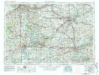
1958 Map of Grand Rapids
USGS Topo · Published 1981About this map
Grand Rapids and the state capital of Lansing anchor this mid-century survey of the Southern Michigan landscape. The map illustrates a period of significant regional connectivity as the interstate system, including I-96 and I-94, began to define travel between major industrial hubs like Battle Creek, Kalamazoo, and Jackson. This industrial backbone is complemented by a dense network of older rail lines such as the C&O RR, GTW RR, and Conrail, which trace the path of earlier 19th-century growth.
Find a feature on this map
205 named features on this map. Tap any name to fly to it.
Don’t see what you’re looking for? This feature index may not catch every label — zoom into the map to look around manually.
Map Details
Editions of this 1958 Grand Rapids Map
2 editions found

Other maps of this area

1902 · Dexter
USGS Topo · 1:62,500

1904 · Ann Arbor
USGS Topo · 1:125,000

1906 · Dexter
USGS Topo · 1:62,500

1906 · Saline
USGS Topo · 1:62,500

1907 · Howell
USGS Topo · 1:62,500

1908 · Ann Arbor
USGS Topo · 1:125,000

1908 · Fowlerville
USGS Topo · 1:62,500

1909 · Howell
USGS Topo · 1:62,500

1909 · Mason
USGS Topo · 1:62,500

1910 · Fowlerville
USGS Topo · 1:62,500