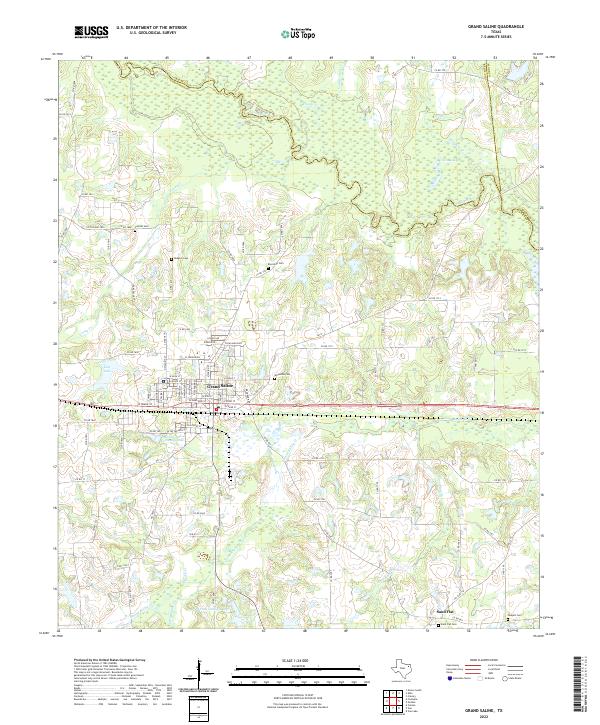
2022 Map of Grand Saline
USGS Topo · Published 2022About this map
The Sabine River forms the northern boundary of this East Texas terrain, winding through a complex of wetlands where Franks Cr and Leatherman Cr converge. The town of Grand Saline dominates the central landscape, clearly defined by its grid of streets and its industrial heritage centered on the Morton Salt Company Lake. This area is a significant hub for genealogists, featuring numerous family and community burial grounds including Riverside Cem, Woodside Cem, and the more remote Rodgers Cem. To the south, the settlement of Sand Flat sits near the headwaters of Chrestman Br, illustrating the transition from the salt-influenced industrial center to a more dispersed rural pattern. Water is a defining element throughout, from the City Lake in town to Darnell Lake Number 4 and the winding course of Grand Saline Cr.
Find a feature on this map
93 named features on this map. Tap any name to fly to it.
Don’t see what you’re looking for? This feature index may not catch every label — zoom into the map to look around manually.
Map Details
Editions of this 2022 Grand Saline Map
This is the sole edition of this map. No revisions or reprints were ever made.
Other maps of this area

1956 · Tyler
USGS Topo · 1:250,000

1956 · Emory
USGS Topo · 1:62,500

1958 · Alba
USGS Topo · 1:24,000

1959 · Calvary
USGS Topo · 1:24,000

1959 · Golden
USGS Topo · 1:24,000

1959 · Grand Saline
USGS Topo · 1:24,000

1959 · Van
USGS Topo · 1:24,000

1959 · Van Lake
USGS Topo · 1:24,000

1959 · Grand Saline
USGS Topo · 1:62,500

1959 · Alba
USGS Topo · 1:62,500