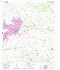
1963 Map of Granger Lake
USGS Topo · Published 1989About this map
San Gabriel River dominates this landscape in eastern Williamson County, shown here during a period of transition as Granger Lake was established. The map depicts a series of water management features, including New Bern Dam and several structures with identified spillway elevations, such as Spillway Elevation 506. These developments significantly altered the drainage patterns of Willis Creek and Sore Finger Creek as they feed into the central reservoir.
Find a feature on this map
26 named features on this map. Tap any name to fly to it.
Don’t see what you’re looking for? This feature index may not catch every label — zoom into the map to look around manually.
Map Details
Editions of this 1963 Granger Lake Map
2 editions found
Other maps of this area

1885 · Taylor
USGS Topo · 1:125,000

1887 · Taylor
USGS Topo · 1:125,000

1894 · Taylor
USGS Topo · 1:125,000

1910 · Buckholts
USGS Topo · 1:24,000

1912 · Buckholts
USGS Topo · 1:31,680

1954 · Austin
USGS Topo · 1:250,000
1963 · Sharp
USGS Topo · 1:24,000

1963 · Friendship
USGS Topo · 1:24,000
1963 · San Gabriel
USGS Topo · 1:24,000
1963 · Davilla
USGS Topo · 1:24,000