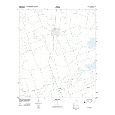
2010 Map of Granger
USGS Topo · Published 2010About this map
Granger serves as the primary hub of this Central Texas landscape, positioned north of the winding San Gabriel River. The area is defined by its deep agricultural roots and a notable density of rural burying grounds that speak to the region's complex genealogical history. To the west of the town center lies Calvary Cemetery, while the eastern outskirts near the Granger Lake shoreline contain Machu Cemetery and Granger Cemetery.
Find a feature on this map
62 named features on this map. Tap any name to fly to it.
Don’t see what you’re looking for? This feature index may not catch every label — zoom into the map to look around manually.
Map Details
Editions of this 2010 Granger Map
This is the sole edition of this map. No revisions or reprints were ever made.
Other maps of this area

1885 · Taylor
USGS Topo · 1:125,000

1887 · Taylor
USGS Topo · 1:125,000

1893 · Georgetown
USGS Topo · 1:125,000

1894 · Taylor
USGS Topo · 1:125,000

1925 · Georgetown 4-d
USGS Topo · 1:48,000

1928 · Round Rock
USGS Topo · 1:62,500

1949 · Round Rock
USGS Topo · 1:62,500

1951 · Round Rock
USGS Topo · 1:62,500

1954 · Austin
USGS Topo · 1:250,000

1963 · Friendship
USGS Topo · 1:24,000