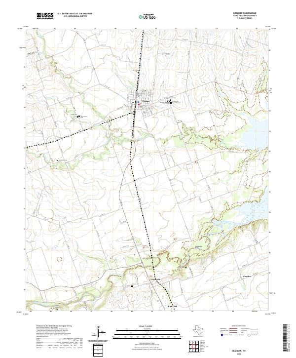
2022 Map of Granger
USGS Topo · Published 2022About this map
Granger stands as the central hub of this agricultural landscape in eastern Williamson County, defined by a dense cluster of local history markers. A notable concentration of cemeteries surrounds the town, including Holy Cross Cem, Granger City Cem, and the Granger Brethern Church Cem. The layout of the town itself is detailed down to individual street names such as W Mesquite and S Brazos St, showing its proximity to the Railroad Reservoir.
Find a feature on this map
86 named features on this map. Tap any name to fly to it.
Don’t see what you’re looking for? This feature index may not catch every label — zoom into the map to look around manually.
Map Details
Editions of this 2022 Granger Map
This is the sole edition of this map. No revisions or reprints were ever made.
Other maps of this area

1885 · Taylor
USGS Topo · 1:125,000

1887 · Taylor
USGS Topo · 1:125,000

1893 · Georgetown
USGS Topo · 1:125,000

1894 · Taylor
USGS Topo · 1:125,000

1925 · Georgetown 4-d
USGS Topo · 1:48,000

1928 · Round Rock
USGS Topo · 1:62,500

1949 · Round Rock
USGS Topo · 1:62,500

1951 · Round Rock
USGS Topo · 1:62,500

1954 · Austin
USGS Topo · 1:250,000

1963 · Friendship
USGS Topo · 1:24,000