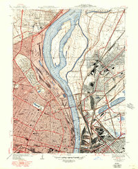
1940 Map of Granite City
USGS Topo · Published 1950About this map
The industrial and riverfront landscape of the Mississippi River takes center stage in this 1940s-era survey, capturing the complex border between Missouri and Illinois. On the western bank, the urban grid of St Louis is densely mapped, featuring prominent landmarks like Stowe Teachers College, Sumner High School, and the iconic Sportsman Park. The map documents a time of heavy rail and river commerce, showing the St Louis Terminal Railroad and the massive National Stock Yards near Brooklyn.
Find a feature on this map
87 named features on this map. Tap any name to fly to it.
Don’t see what you’re looking for? This feature index may not catch every label — zoom into the map to look around manually.
Map Details
Editions of this 1940 Granite City Map
4 editions found
Other maps of this area

1888 · St. Louis
USGS Topo · 1:62,500

1927 · Alton
USGS Topo · 1:62,500

1927 · St. Charles
USGS Topo · 1:62,500

1931 · French Village
USGS Topo · 1:24,000

1933 · Granite City
USGS Topo · 1:24,000

1933 · Jefferson Barracks
USGS Topo · 1:24,000

1933 · Cahokia
USGS Topo · 1:24,000

1933 · Clayton
USGS Topo · 1:24,000

1933 · Saint Charles
USGS Topo · 1:62,500

1934 · Cahokia
USGS Topo · 1:24,000